Australia cloud climatology project
Funded by: Federal Government, now also WASTAC small grants
Researchers: Merv Lynch, Brett Nener (UWA), Helen Chedzey
Period: 2018-2021
When studying the environment, the ability to observe large areas of the globe can be restricted by the location of ground-based instruments or be complicated by the expense when considering airborne experiments that will only cover a small area. Being able to record measurements regularly across the globe can be achieved with the use of satellite technology and is commonly referred to as satellite remote sensing.
Atmospheric remote sensing is involved in looking at all aspects of the atmosphere such as aerosols, water vapour and clouds. Cloud research and the monitoring of cloud physical and microphysical properties can be used for in-depth short-term analysis of weather systems as well as long-term climate studies.
The use of satellite technology in the study of meteorology has grown from humble beginnings in the 1960s to the most recent advanced multispectral imagers. As methods have improved, more detailed information of our climate has been made available for study. Where initially there were only photographs of cloud systems, now there are widespread radiometric measurements that are used to derive an extensive list of cloud physical and microphysical products.
Studying these cloud physical and microphysical properties allows in-depth analysis of temporal events, and if examined over a sufficiently long period of time, allows us to measure an important component of our climate and any amount of change that may have occurred.
As many satellites now exceed their lifespan specifications and there is established launching of successive platforms containing similar instruments, the opportunity for long-term cloud studies is rapidly expanding.
Research facts
Research conducted using data sets from the following instruments:
- High-resolution Infrared Radiation Sounder (HIRS) – 17 years of data
- MODerate-resolution Imaging Spectroradiometer (MODIS) – 20+ years of data
- Advanced Very High-Resolution Radiometer (AVHRR) – 40 years of data, 0.1 degree resolution
Sample of physical and microphysical cloud data products studied
- Cloud Fractional Amount
- Cloud Emissivity
- Cloud Optical Depth
- Cloud Top Pressure
- Cloud Top Temperature
- Cloud Effective Radius
Examples of regional and national cloud analysis (completed, underway and planned):
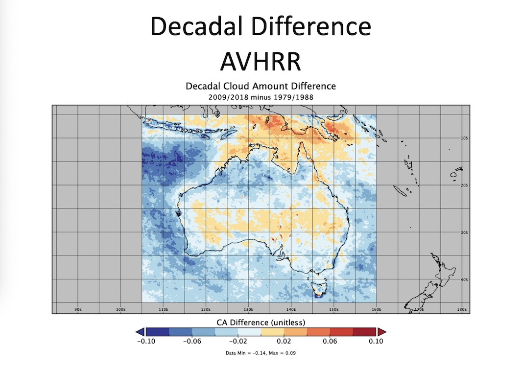
- Seasonal, Annual and Decadal summaries of cloud products
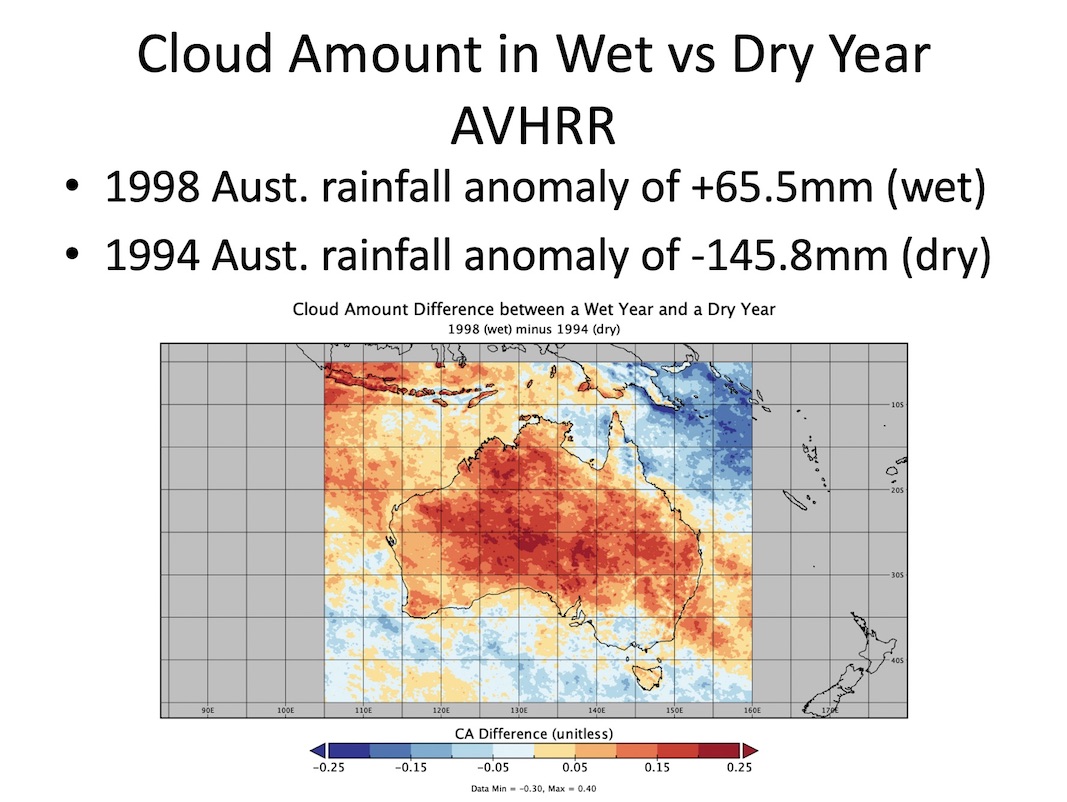
- Cloud product investigations of years with above and below average rainfall
- Use of cloud physical and microphysical products to enhance the characterisation of potential rainfall clouds
- Summaries of clear sky observations to benefit laser communications
- Comparison of numerical model predicted cloud cover and climatology data sets
Project collaboration
University of Wisconsin, Madison, Wisconsin, USA
University of Western Australia, Perth, WA, Australia
Monash University, Clayton, VIC, Australia
Example results